
Fichier:Belgieluik.png
Pas de plus haute résolution disponible.
Belgieluik.png (398 × 335 pixels, taille du fichier : 6 Kio, type MIME : image/png)
| Ce fichier et sa description proviennent de Wikimedia Commons. | Accéder au fichier sur Commons |
Description
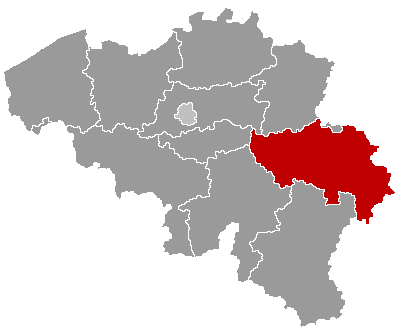
| Description | Map of Belgium with the 3 regions together, with the province of Liège colored red. |
| Date | |
| Source | Wikimedia Commons (Article 'Maps_of_Belgium') |
| Auteur | User 'Morwen' |
| Autorisation (Réutilisation de ce fichier) |
none needed , seen the GNU Free Documentation License. |
Conditions d’utilisation

|
Vous avez la permission de copier, distribuer et modifier ce document selon les termes de la GNU Free Documentation License version 1.2 ou toute version ultérieure publiée par la Free Software Foundation, sans sections inaltérables, sans texte de première page de couverture et sans texte de dernière page de couverture. Un exemplaire de la licence est inclus dans la section intitulée GNU Free Documentation License. |
| Ce fichier est disponible selon les termes de la licence Creative Commons Attribution – Partage dans les Mêmes Conditions 3.0 (non transposée). | ||
| ||
| Ce bandeau de licence a été ajouté à ce fichier dans le cadre de la procédure de mise à jour des licences des images sous GFDL. |
Historique du fichier
Cliquer sur une date et heure pour voir le fichier tel qu'il était à ce moment-là.
| Date et heure | Vignette | Dimensions | Utilisateur | Commentaire | |
|---|---|---|---|---|---|
| actuel | 24 mai 2006 à 18:58 | | 398 × 335 (6 Kio) | Btrs | {{Information| |Description= Map of Belgium with the 3 regions togheter , with the province of Liège colored red. |Source=Wikimedia Commons (Article 'Maps_of_Belgium') |Date=24 May 2006 |Author=User 'Morwen' |Permission=none needed , seen the GNU Free Do |
Utilisation du fichier
La page suivante utilise ce fichier :
Usage global du fichier
Les autres wikis suivants utilisent ce fichier :
- Utilisation sur ar.wikipedia.org
- Utilisation sur bg.wikipedia.org
- Лиеж
- Лиеж (провинция)
- Уанз
- Юи
- Верлен
- Клавие
- Ерстал
- Сен Никола (Белгия)
- Вервие
- Вервие (окръг)
- Шаблон:Провинция Лиеж
- Амел
- Бален (Лиеж)
- Бург Ройланд
- Бюлинген
- Бютгенбах
- Келмис
- Лонцен
- Ойпен
- Ререн
- Санкт Вит
- Велкенрат
- Дизон
- Ерв
- Жале
- Лиерньо
- Лимбур
- Малмеди
- Обел (Белгия)
- Олн
- Пепенстер
- Пломбиер
- Ставело
- Стумон
- Тимистер-Клермон
- Троа Пон
Voir davantage sur l’utilisation globale de ce fichier.